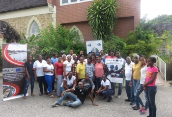
In 2019, the Livelihood Based Assessment and Contingency Planning approach was applied in St. Vincent and the Grenadines to provide pre-disaster livelihood information for eleven communities involved in the Volcano Ready Communities in the St. Vincent and the Grenadines (VRC in SVG) project.
Chateaubelair is one of the communities that was included in this process and this report provides the Livelihood Baseline Assessment (LBA) information that resulted from the assessment process.
The report illustrates that Chateaubelair is a heavily forested region located along the West coast of St. Vincent in the parish of Saint David. Commonly referred to as “Chateau”, it is a farming and fishing town named after Joseph Chatoyer, Chief of the Black Caribs.
According to the 2012 Housing and Population Census, the town of Chateaubelair has an estimated four hundred and fifty-eight (458) households with a population of one thousand four hundred twenty-one (1,421). Data related to the wider Chateaubelair Census Division are used to indicate the social realities of the town (education, health and housing). These are discussed in detail in Chapter 3.
Based on an earlier conducted Community Engagement Survey (CES) funded by the project in September 2018, community development activities are seen as important by a majority of residents of the community but only a few persons play active leadership roles through involvement in an organisation. The vision, mission and objectives of the community groups in Chateaubelair and other results pertaining to the survey are outlined in Chapter 4. Chapter 4 also provides an overview of the governance structure of the community.